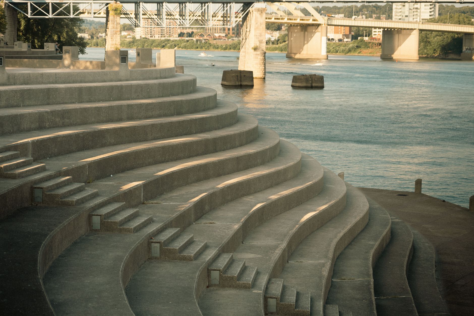

Pittsburgh has a stairway problem, but not the one you'd expect. The city is famous for its hillside staircases, the 800-plus public steps that climb from riverbanks to ridge-top neighborhoods because roads were never practical. But the stairs that go down to the water? Mostly ignored. Overgrown in places, unmarked in others, and almost completely off the mental map of residents who jog past them twice a week without registering what they are.
These are Pittsburgh's river stairs: stone and concrete descents that connect street level to the water's edge along the Allegheny, Monongahela, and Ohio. They were built for industrial-era workers, fishermen, and ferry passengers. Some have been restored. Some are falling apart. And a few are genuinely beautiful in the way only forgotten infrastructure can be.
Why river access matters in Pittsburgh
Pittsburgh sits at the confluence of three rivers, which is a geographical fact that the city has spent the better part of 150 years ignoring at street level. Steel mills consumed the banks. Flood walls went up. Then highways arrived, and the rivers became something you crossed rather than visited.
That changed slowly. Riverlife Pittsburgh has spent more than two decades turning industrial remnants along the city's three rivers into vibrant public spaces, and the results are now visible from the North Shore to the South Side Riverfront Trail. But the river stairs predate all of that. They represent an older logic: that the water was something Pittsburghers moved toward, not past.
Today, the stairs matter again. Kayakers use them as put-in points. Open-water swimmers scout them for entry. Anglers set up at the bottom. And a small community of urban explorers has quietly mapped most of them.
Where to find them
The most accessible set sits near the confluence at Point State Park, where stone steps descend from the plaza to the water on both the Allegheny and Monongahela sides. These are maintained, wide, and genuinely inviting. On a summer evening, they're the best seats in the city.
On the Allegheny side, a series of less-publicized descents dot the North Shore between the Clemente Bridge and the 31st Street Bridge. A few are remnants of old industrial loading areas, their stone worn smooth by decades of boot traffic. They're intact but unmarked, and most North Shore joggers pass them without looking down.
The South Side has two worth knowing. One drops from the Birmingham Bridge plaza to the Monongahela's edge. Another, closer to the South Side Riverfront Park boat launch, is newer construction but follows the same logic: a direct, human-scaled path to the water. Neither has a sign. Both are easy to find once you know to look for the gap in the flood wall.
The Ohio River has the fewest maintained stairs, partly because residential development along that corridor came later and partly because flood events have been harder on those structures. The stairs near the West End Bridge are the best-preserved on that stretch.
The swimming and paddling connection
River stairs are practical infrastructure for anyone who wants to get into the water rather than just look at it. If you're curious about swimming in the rivers, Pittsburgh's open-water swimming community has built up a body of practical knowledge about where and when to go in safely. The stairs factor into that: a controlled descent is easier and safer than a rocky scramble, especially on the Allegheny's North Shore where the banks drop steeply.
Kayakers and paddleboarders use the stairs as informal launches when designated boat ramps are crowded or inconveniently located. The stairs near the 9th Street Bridge on the Allegheny are a particular favorite for this, close to parking and just wide enough to manage a kayak.
What's being lost and what's being saved
Not all of the stairs are holding up. Some have lost entire sections to erosion or flood damage. Others have been gated off by adjacent property owners. A handful were quietly demolished during the flood wall maintenance work of the 1990s and early 2000s, leaving only iron handrail stubs as evidence they existed.
The preservation picture is uneven. Steps inside maintained park boundaries, like those at Point State Park or the South Side Riverfront, get regular attention. Steps that fall in gray zones between park and private property don't. Pittsburgh's Department of Public Works has no consolidated inventory of river stairs, which means they don't get maintenance schedules, they get reactions when something breaks or someone complains.
Local environmental groups have started paying more attention. Some of the same organizations involved in stream and trail advocacy have flagged river access as a priority, particularly as the city's outdoor recreation culture grows and the rivers become busier with non-motorized watercraft.
How to use them without getting into trouble
A few practical notes. The stairs at Point State Park are open during park hours, which typically run from dawn to 11 p.m. The less formal stairs on the North Shore and South Side are technically accessible year-round, but flood stage can cover them entirely. Allegheny County's river gauge data is public and worth checking before you plan a visit. During spring runoff, even stairs that look accessible at the top may have their bottom 6 feet underwater.
Fishing from the stairs is legal and common. Swimming from them puts you in the same regulatory gray zone as any other river entry point: not explicitly prohibited, but not formally sanctioned either. The city's public stairway network operates under a similar implicit-use framework, where access is assumed unless a stairway is explicitly gated or signed.
Wear shoes with grip. The stone steps near the waterline are slick even when the weather has been dry, and the angle of descent on several of the older stairs is steeper than modern building codes would allow.
A different way to see the rivers
Pittsburgh's relationship with its rivers is still being renegotiated. The kayaking scene is growing, the swimming community is more vocal than it's ever been, and the riverfront trail system keeps expanding. But none of that fully replaces the simple, direct experience of walking down a set of old stone steps and arriving at the water's edge with the current moving past your feet.
The river stairs aren't on any official tourist map. They don't have interpretive signage or QR codes. Some of them are easier to find by satellite image than by street-level searching. That's part of what makes them worth looking for.