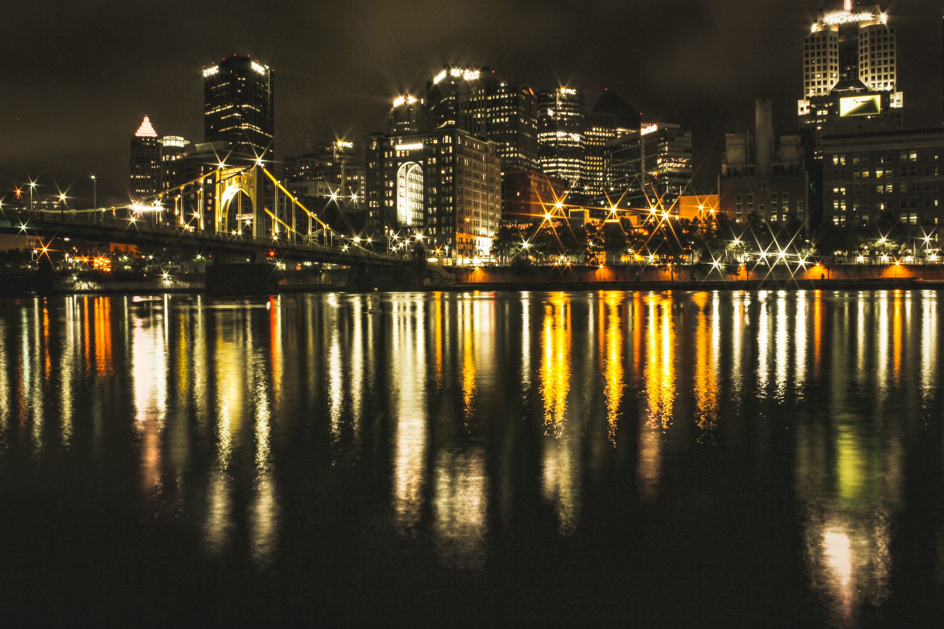

The Pittsburgh skyline is one of those rare urban views that earns genuine gasps. Unlike cities built on flat land where buildings simply rise from a grid, Pittsburgh's skyline emerges from a bowl of hills, rivers, and valleys, creating a compressed, theatrical profile that appears without warning from the right vantage point. A first-time visitor emerging from the Fort Pitt Tunnel onto the Parkway bridge has zero warning before the entire skyline opens up at once, framed by the Monongahela below and the Allegheny just beyond. It's the kind of view that stops conversation mid-sentence.
What makes the Pittsburgh skyline different
Pittsburgh's topography does the heavy lifting. The city sits at the confluence of the Allegheny and Monongahela rivers, which merge at the Point to form the Ohio. That geography creates a natural stage: the downtown core, called the Golden Triangle, is pinned on three sides by water, which means no development can creep outward and dilute the view. The hills rising on all sides also compress the skyline into a tight vertical stack that photographs well and reads even better in person.
The city's bridges add to the effect. Pittsburgh has 446 bridges, more than any other city in the world, and several of them sit close enough to downtown that they appear in almost every skyline photograph. The three yellow spans of the Roberto Clemente, Andy Warhol, and Rachel Carson bridges, known collectively as the Three Sisters, are the most photographed. They're the only set of three nearly identical self-anchored suspension bridges in the world, and they frame the Allegheny River side of the skyline with a geometry you won't find anywhere else. You can read more about what Pittsburgh's bridges tell us about the city's geography and engineering history.
The best spots to see the skyline
Pittsburghers are protective of their favorite viewpoints, and with good reason. Each one offers a genuinely different composition.
Mount Washington is the most famous. The neighborhood sits on a ridge directly across the Monongahela from downtown, and its overlooks at Grandview Avenue deliver the full skyline at eye level. Duquesne Incline and Monongahela Incline both deposit visitors right at the ridge, and the overlook benches fill up every clear evening. Serious photographers show up before sunrise to catch the city reflected in the river below. If you want to combine the view with a drink, Pittsburgh's best rooftop bars include spots on the South Side with strong sightlines toward the Golden Triangle.
Point State Park puts you inside the view rather than above it. Standing at the fountain where the rivers converge, you can look back and see downtown rising directly behind you, with the bridges fanning out in both directions. It's the most intimate skyline experience the city offers, and it's free.
The Fort Pitt Bridge approach is best experienced by car, ideally as a passenger. The tunnel pops you out mid-bridge, and for about four seconds the entire skyline fills your windshield before the road curves and traffic demands your attention again. Pittsburgh residents who commute this route daily report that they never fully stop noticing it.
Emerald View Park and the overlooks along Grandview Avenue extend the Mount Washington experience in both directions, offering slightly different angles on the downtown cluster. The western end of Grandview picks up more of the West End Bridge and the Ohio River valley, which has its own quieter drama.
The North Shore trail, running along the Allegheny behind PNC Park and Acrisure Stadium, gives a water-level perspective looking south toward downtown. The view is less dramatic than Mount Washington but far less crowded, and the Three Sisters bridges frame the scene perfectly on a clear day. This trail connects to the riverfront trail network that Riverlife Pittsburgh has spent decades developing along all three rivers.
The buildings that define the skyline's shape
Three structures dominate the Pittsburgh skyline from almost every angle.
The USX Tower (now officially 600 Grant Street) is the tallest building in Pittsburgh at 841 feet, and its dark, angular profile sets the skyline's peak. It opened in 1970 and still reads as unmistakably modern despite its age, in part because Pittsburgh hasn't built anything taller since.
The PPG Place complex, designed by Philip Johnson and completed in 1984, is the most visually distinctive cluster. Its neo-Gothic towers are clad in mirrored glass that picks up whatever light the sky provides: pink at dusk, silver on overcast days, nearly invisible on clear afternoons. From a distance, the spires look almost ecclesiastical, which was Johnson's point.
The Gulf Tower, completed in 1932, carries an Art Deco pyramid crown that once housed weather-beacon lights. The crown still reads clearly from across the rivers and gives the skyline its most recognizable historic silhouette.
How the skyline changes through the day
The Pittsburgh skyline shifts dramatically with light. Morning fog sits in the river valleys and often wraps the base of the downtown buildings while the upper floors catch early sun, an effect locals call the city "floating." Midday is the flattest light. Late afternoon, when the sun drops toward the Ohio River corridor and hits the western faces of the buildings, produces the warmest photographs. Blue hour, the 20 minutes after sunset when the sky is still luminous and building lights have come on, is the standard answer when photographers are asked when to shoot. The PPG Place towers take on their best color at exactly this moment.
Winter offers something summer can't: clear air and long shadows that sharpen the skyline's edges. Snow on Mount Washington turns the ridge into a white foreground that contrasts cleanly against the gray-and-lit towers across the river. It's one of those compositions that feels almost too good to be real, and it recurs reliably every January and February.
Why the skyline looks the way it does from the air
Anyone flying into Pittsburgh International from the east gets a window-seat reveal that matches the tunnel approach on the ground. The Allegheny Front and the ridge lines of Western Pennsylvania give way to the river valleys, and then the compact cluster of downtown appears, circled by green hills and cut by the three rivers. It reads small, tightly packed, and almost improbably colorful for an industrial city. That compactness is the product of geography: the Golden Triangle is only about 0.7 square miles in area, which concentrates the skyline in a way that larger, flatter downtowns can't replicate.
Pittsburgh's skyline isn't the tallest or the largest. It's the most dramatic per square mile, and that specificity is what makes it worth a dedicated trip to the right overlook on the right evening.